Kenya: Deployment to Operation Support Hope
by Tim Vasquez
Link to the longer version of this story
In July, 1994 the turmoil in Rwanda reached epic proportions. A flood
of refugees equivalent to the population of Kansas City escaped civil war by
fleeing to Goma, Zaire. The situation was covered heavily by the
international media, prompting a major relief effort. The Department of
Defense mounted the operation, and
the task fell upon our airlift squadron at Dyess AFB, Texas to help
support the operation. Just 36 hours after the word came down, fifty of us
from Dyess were on our way aboard a C-5B cargo jet to Kenya.
The operation involved many units from all branches of the service,
the United Nations, and the French military.
The basic layout was that freighter jets would fly supplies from Germany
to Uganda, offload, fuel up in Kenya, then return to Germany, in a nearly
continous cycle. Smaller planes would ferry the cargo from Uganda to Goma.
Our Dyess folks went to Mombasa to establish a small "base" along the
flightline, called a TALCE (Tactical Airlift Control Element). In short,
our Mombasa operation contracted refueling operations,
managed ramp space, made sure aircrews had a hotel room waiting for
them, did spot maintenance on the jets, and provided weather briefings
(the latter of which myself and 5 others were responsible).
This lasted about two months, and was of such scale that our jets often
crowded the small ramp, with as many as 3 or 4 of the giant C-5B cargo
planes stopped over at once. One night the Russians even brought in a
mammoth An-124 cargo jet that dwarfs even the C-5B.
The job was fairly routine, and our off-duty time was spent twelve miles
away at hotels along the beach that the Air Force had contracted with. Not
a bad way to spend two months in Africa, though the Army had set up a
TALCE of their own in Goma without any of the luxuries of Mombasa. In
any case, I did bring back some pictures, and these show glimpses at
everyday scenes in Mombasa.
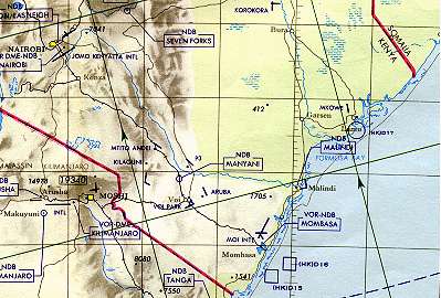
Here's a map that gives the basic layout of eastern Kenya. Mombasa is
right down there in the southern corner.
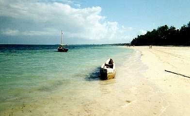
This is the Indian Ocean. There are many miles of beautiful beaches
along Mombasa's coast. The only disappointment is that it's sheltered
by a reef a mile offshore (which you can see in this photo), so you don't
get to watch the big waves crash in.
The needleleaf trees certainly look odd at 4 degrees south latitude.
I'm not sure why they favor the beaches of Mombasa. The folks on the
beach in this photo are more than likely peddlers for overpriced souvenirs,
trying to find an unsuspecting tourist.
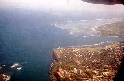
Here we see a view of eastern Mombasa from the air, looking directly
south. The large building along the coast at the bottom of the photo is
the historic missionary site of Fort Jesus. In the distance is the
outlying districts, containing many tourist hotels and getaway retreats.
A coral reef can be seen prominently a mile offshore.
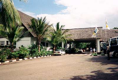
This is the Reef Hotel, the second hotel we stayed at. It wasn't the
Hilton, but it was a very homely, comfortable place along the beach. We
stayed here for about 4 weeks.
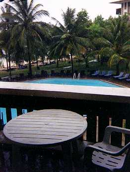
After the contract changed, we were moved into the four-star
Intercontinental, which was about six miles further away from Mombasa but
more upscale. Here we see a view out my balcony, which had a nice view
of the pool and the beach.
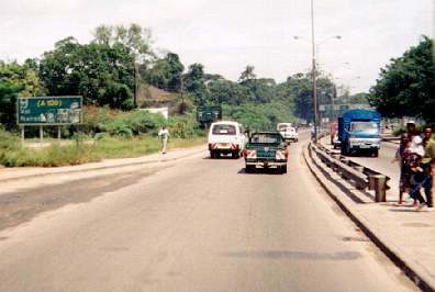
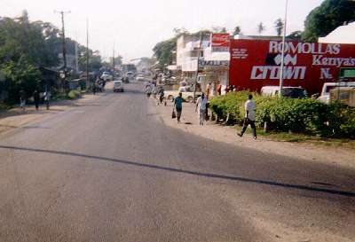
I believe this was taken around the Kisauni district of Mombasa, showing
one of the four-lane highways leading into the city. Pedestrian traffic
is in abundance. There is an abandoned tollbooth near this area that
I remember clearly, because late one night our Kenyan bus driver flew
through it at 60 mph. With only inches to spare, it's a complete miracle
we didn't end up in the hospital.
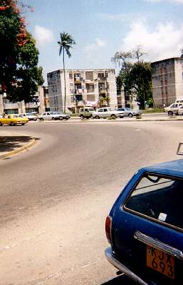
Near one of the intersections in downtown Mombasa we can see one of
the small concrete apartments that might be home to a lower-middle class
resident. They're quite spartan.
It's a busy morning in the Changamwe district of Mombasa, which centers
around the economic presence of a huge oil refinery and the airport. When
President Moi visited Mombasa in mid-September, this street was lined with
spectators, welcome signs, and flowers for many, many miles. This street
also is the beginning of the main highway between the capital city
of Nairobi and Mombasa. Doesn't quite look like "Interstate 40",
does it?
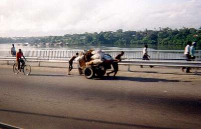
If your business can't afford a truck, this is how you get your goods
around. These carts are usually rented by the day, and are seen along the
highways all over the city, stacked with bricks, maize, or lumber.
Where the bridge rises steeply from the waters of the bay into the Changamwe
district, we used to watch in awe as dozens of these folks struggled up
the hill with hundreds of pounds of goods. The "uphill cart push" is a
Herculean activity that certainly deserves to be introduced as an
Olympic sport.
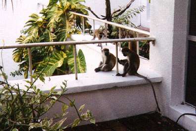
Monkeys are common around many of the hotels, but one near the White
Sands Hotel (pictured here) seemed to be the home of a small city of them.
At the Reef, an Indian hotel guest in the room above me made the mistake of
leaving his balcony door unlocked. As I sat at my balcony, I began seeing
cigarettes dropping to the ground. Then came a couple of packs, then the
carton. I'm not sure what else the monkey found in his room.
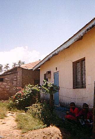
This is a typical home in the Changamwe district of Mombasa near the
airport. I haven't been inside one, though, but having driven through there
at night, I discovered they don't have electricity. Regardless, they do
offer a solid shelter and room outside for odds and ends or gardening.
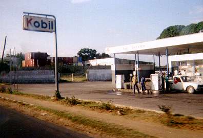
This gas station near the Makupa causeway always got snickers from us
as we drove by it. Makes you wonder how legitimate it really is. And
no, there's no Quick Marts in any of these gas stations. Just oil and
spare parts.
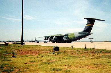
This is the massive C-5B freighter jet that was the backbone of the
Rwanda relief airlift.
Here we see one at Dyess AFB an hour before it took us all the way to Africa.
They flew relief supplies out of Frankfurt and offloaded at Entebbe, Uganda.
From there, the C-130's delivered the cargo from Entebbe into Goma, Zaire,
and some of the other smaller airstrips near the refugee camps. The C-5B's
left Entebbe, flew 200 miles to Mombasa to fuel up (Mombasa is a major
port city), then flew back to Frankfurt via Cairo.
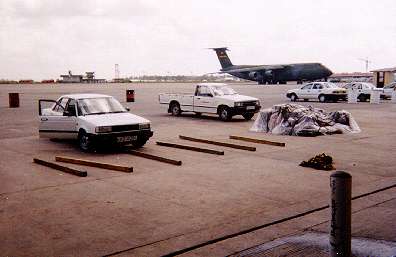
It's an unusually quiet afternoon on the Mombasa flightline. In the
distance is a C-5B waiting for its aircrew to finish their crew rest.
Pieces of lumber in the foreground await forklifted cargo.
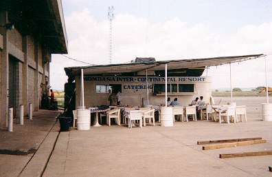
Adjacent to the flightline is a catering service run by the hotel
most of us stayed at. The food was a bit greasy and nothing to write home
about, but it was the only restaurant within a mile and was open 24 hours
a day. On the left is the concrete building that served as an office for
most of us, including the weather shop. The mobile command post
overlooking the ramp is just behind the catering truck.
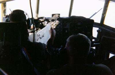
This photo was taken aboard a U.S. Marines C-130, about 50 miles off
the Somali coast. The pilot is making the most of a few idle moments to
catch up on the latest news in the Stars and Stripes newspaper.
I came along that afternoon to watch them practice
maneuvers with a group of Navy helicopters. The helicopters were based
on ships, though, and we didn't land in Somalia! At the time of this
photo, Somalia was in a state of complete chaos, with no government, a
collapsed economy, and no link with the outside world. The pilot reminded
us of the seriousness of the situation if we had to make an emergency
landing in Somalia. Fortunately, the flight went without a hitch and
we were back in Mombasa by late evening.
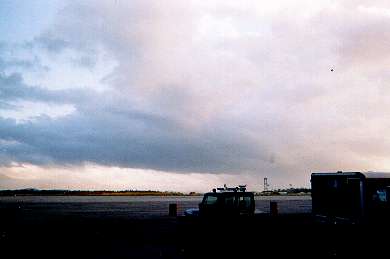
Morning showers roam westward across the airfield, formed by convergence
between the land breeze and the prevailing southerly monsoon winds. Most
of our rain fell in the morning hours, and each day at the time of maximum
heating, the boundary had usually already moved inland in the form of a
sea breeze, leaving us partly cloudy and dry.
All photos on this page Copyright 1994 Tim Vasquez
All rights reserved
Return to main menu