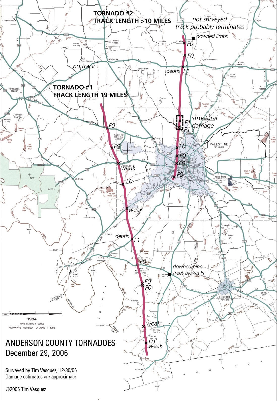
Palestine, Texas Tornadoes
December 29, 2006

Track of tornadoes. Click to enlarge.
Radar loops (new) (allow a minute for all images in frame to load)
FWS / Fort Worth, reflectivity, 0.5 deg
FWS / Fort Worth, reflectivity, 1.5 deg
FWS / Fort Worth, reflectivity, 2.4 deg
FWS / Fort Worth, reflectivity, 3.4 deg
FWS / Fort Worth, spectrum width, 0.5 deg
FWS / Fort Worth, storm relative velocity, 0.5 deg
FWS / Fort Worth, vertically integrated liquid
GRK / Fort Hood, reflectivity, 0.5 deg
GRK / Fort Hood, reflectivity, 1.5 deg
GRK / Fort Hood, reflectivity, 2.4 deg
GRK / Fort Hood, reflectivity, 3.4 deg
GRK / Fort Hood, spectrum width, 0.5 deg
GRK / Fort Hood, storm relative velocity, 0.5 deg
GRK / Fort Hood, vertically integrated liquid

Debris field. Nr FM 1990 and CR 2137 southwest of Palestine, looking NW. A lot of work crews were in this area.

Downed pine trees and debris on FM 1990 near CR 2137, southwest of Palestine, looking SW. Tree was blown by east-northeast winds towards track.
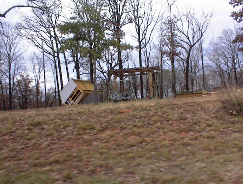
Overturned shed. Near CR 2202 (Salt Works Rd) and CR 420 west of Palestine, looking N.

Billboards blown over on Loop 256 near Queen St, looking N.

Missing roof on southeast exposure. A lot of lines were down in this area and Asplundh crews were cutting limbs.
Near CR 404 and CR 403 north of Palestine, looking NW.
Return to Tim's web pages